UN
3 Houndsden Road
£ 490,000
Description
We don't have a Description for this property.
- Bedrooms
- 4
- Bathrooms
- 0
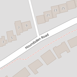

Leaflet © OpenStreetMap contributors
The heatmap indicates the level of crime in the area. The color of the heatmap indicates the crime severity and recency.
Metrics Year-on-Year
- Average area value
- 751,426.00 £Increased by 83.24 %
- Average area rental value
- 1,466.00 £/moDecreased by 0.54 %
- Est rental Yield
- 2.34 %Decreased by 45.71 %
- Crime Rate
- 1.00 %Unchanged by 0.00 %
from 410,079.00 £
from 1,474.00 £/mo
from 4.31 %
from 1.00 %
Nearby Schools
| Name | Type | Ofsted | Distance |
|---|---|---|---|
| Eversley Primary School | Community School | Outstanding | 0.73 KM |
| Keble Preparatory School | Other Independent School | 0.75 KM | |
| Grange Park Primary School | Academy Converter | 0.92 KM | |
| Highlands School | Community School | Outstanding | 1.06 KM |
| St Paul'S Cofe Primary School | Voluntary Aided School | Outstanding | 1.17 KM |
Images
Nearby Streets
| Name | Average Price | Average Sqft | Distance |
|---|---|---|---|
| Springbank | £ 389,995 | 0 | 0.00 KM |
| Wynsmere Court | £ 0 | 0 | 0.00 KM |
| Green Dragon Lane | £ 999,995 | 0 | 0.00 KM |
| Hadley Close | £ 950,000 | 0 | 0.00 KM |
| Askew Way | £ 0 | 0 | 0.00 KM |
Nearby Transport
| Name | NLC | TLC | Distance |
|---|---|---|---|
| Winchmore Hill | 6024 | WIH | 1.06 KM |
| Grange Park | 6029 | GPK | 1.33 KM |
| Palmers Green | 6021 | PAL | 2.33 KM |
| Enfield Chase | 6010 | ENC | 2.55 KM |
| Gordon Hill | 6028 | GDH | 3.12 KM |
Nearby Listings
| Address | Price | Type | Score | Distance |
|---|---|---|---|---|
| Houndsden Road, London , N21 | £ 1,300,000 | BUY | 6 / 10 | 0.10 KM |
| Houndsden Road, London | £ 1,300,000 | BUY | 7 / 10 | 0.10 KM |
| Houndsden Road, London | £ 550,000 | BUY | 6 / 10 | 0.17 KM |
| Houndsden Road, London | £ 625,000 | BUY | Unknown | 0.18 KM |
| Brookside, London, N21 | £ 400,000 | BUY | 6 / 10 | 0.21 KM |
Nearby Properties
| Address | Price | Distance |
|---|---|---|
| 15 Houndsden Road | £ 1,550,000 | 0.00 KM |
| 3 Houndsden Road | £ 490,000 | 0.00 KM |
| 37 Houndsden Road | £ 885,000 | 0.02 KM |
| 7 Houndsden Road | £ 640,000 | 0.02 KM |
| 33 Houndsden Road | £ 315,000 | 0.02 KM |